Guide · Travel
East Sumba or West Sumba: which side should you choose?
Savanna and silence in the east, villages and waterfalls in the west: an honest comparison of Sumba's two sides, with a table.
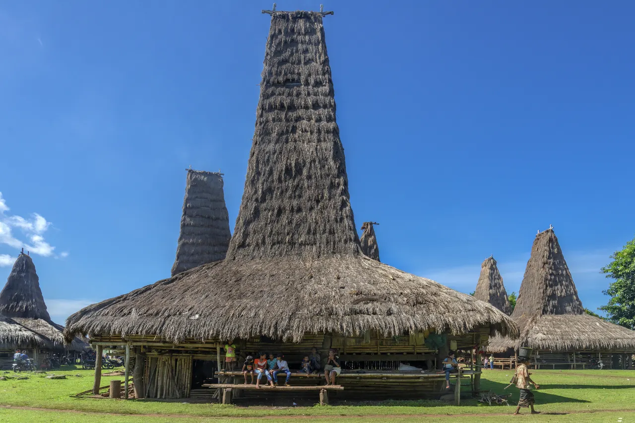
Choose West Sumba, reached through Tambolaka airport, for traditional Marapu villages, the Pasola in February and March, Weekuri Lagoon and waterfalls within 1-2 hours of each other. Choose East Sumba, reached through Waingapu airport, for savanna hills such as Wairinding, calm north-coast beaches, royal weaving villages and far fewer people. The two airports are about 170 km and 4-5 hours apart by car, so with five days or more the best plan is to fly into one and out of the other.
- West gateway
- Tambolaka (TMC): Batik Air daily from Bali, plus Nam Air and Sriwijaya Air
- East gateway
- Waingapu (WGP): TransNusa from Bali 4x a week
- Distance between them
- About 170 km, 4-5 hours by car
- Rainfall
- Waingapu about 900 mm a year; West Sumba Regency about 2,659 mm
- Pasola
- West only: Kodi and Lamboya (usually February), Wanokaka and Gaura (usually March)
- East Sumba visitors
- 41,524 in 2025, about 1 in 8 foreign
Two mornings on the same island. In the west, mist lifts off the Waikabubak plateau, buffaloes wade through flooded rice fields and the thatched peaks of a clan village stand on every wooded hill. In the east, the sun comes up over grass the colour of straw, a line of horses crosses a ridge and the road runs empty to the horizon. Sumba is one island, but its two ends feel like different countries.
The short answer: choose West Sumba (the side served by Tambolaka airport) if you want traditional villages, the Pasola, Weekuri Lagoon and waterfalls with short drives between them. Choose East Sumba (Waingapu airport) if you want savanna, big empty views, weaving villages and long sunsets. With five days or more you do not have to choose: fly into one airport and out of the other.
What "east" and "west" mean on Sumba
Sumba has four regencies. When travellers say "the west" they usually mean two of them together: Southwest Sumba, with Tambolaka airport and the Kodi coast, and West Sumba, the small highland regency around Waikabubak. "The east" is East Sumba, governed from Waingapu: about 7,000 km², roughly 64% of the island, but home to fewer than a third of its people. Between them lies Central Sumba, which has no airport and is mostly seen on the drive across.
Sumba this week, every Sunday
The week's news, one place worth the trip and practical travel notes. Free, and you get our 7-day Sumba guide (PDF) on signing up.
One email a week. No spam. Unsubscribe in one click. Sumba this weekThe two airports are about 170 km apart, 4-5 hours by car via Waikabubak, Waibakul and Lewa. That distance is why the choice matters on a short trip.
East Sumba or West Sumba at a glance
| West (Southwest and West Sumba) | East (East Sumba) | |
|---|---|---|
| Landscape | Greener and wetter: rice fields, forest, a plateau at about 400 m around Waikabubak, coral limestone and cliffs on the Kodi coast | The island's rain shadow: open savanna and limestone hills, golden in the dry season, with green river valleys and forest in the far south |
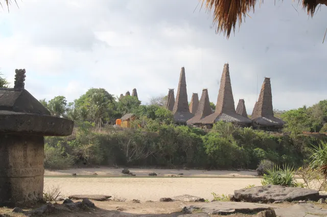
| Villages and culture | Marapu villages with the tallest roofs (Ratenggaro, Wainyapu, Tarung, Praijing); the Pasola in February and March | Royal villages (Prailiu, Rende, Pau) with carved tombs; the heartland of ikat and pahikung weaving; no Pasola |
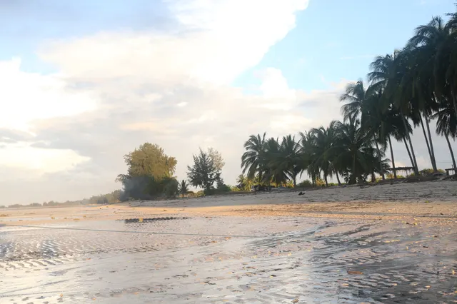
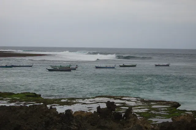
| Beaches | Weekuri Lagoon for calm swimming; coves and cliffs at Mandorak and Bawana; surf at Pero, Marosi and Kerewe; the open sea is often rough | Calm, shallow north coast (Walakiri, Puru Kambera, Londa Lima); remote surf bays in the south (Tarimbang, Kalala) |
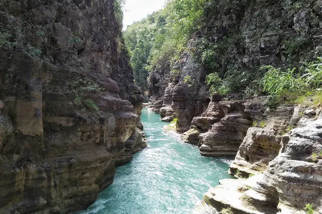
| Waterfalls | Lapopu (about 90 m), Matayangu (jungle trek) and Waikelo Sawah, all reached from Waikabubak | Tanggedu (about 2 hours plus a 3 km walk) and Waimarang (1.5-2 hours plus a 20-45 minute walk) |
| Roads and distances | Most sights 1-2 hours from Tambolaka or under an hour from Waikabubak; more traffic; some unpaved last stretches | Long, empty drives: Rende about 70 km, Tarimbang about 87 km and 3 hours; south-coast roads are poor and can be impassable in the rains |
| Airport and flights | Tambolaka (TMC): Batik Air daily from Bali, about 1h15, plus Nam Air and Sriwijaya Air several times a week | Waingapu (WGP): TransNusa non-stop from Bali four times a week (Tuesday, Wednesday, Friday, Saturday); other routes via Kupang |
| Crowds | The busier side: Southwest Sumba is the most populous regency, with well over 200 people per km²; Weekuri and Ratenggaro are popular, so go early | Fewer than 40 people per km²; 41,524 visitors in the whole of 2025, about 1 in 8 of them foreign |
| Best months | Dry season, roughly May-September; February-March for the Pasola, in the rains | Dry season, roughly May-November; hills gold from mid-year, green from about March |
Why choose West Sumba
The west packs more into less road. From Tambolaka you can reach Weekuri Lagoon in 1.5-2 hours, Ratenggaro in 1-1.5 hours and Waikabubak in about an hour; from Waikabubak, Praijing is 3 km away and Lapopu waterfall about 16 km. This is also where Marapu, the ancestral belief of Sumba, is most visible in daily life, and the only part of the island where the Pasola is held: in Kodi and Lamboya, usually in February, and in Wanokaka and Gaura, usually in March.
The price of that density is company. Southwest Sumba is the most populous regency, the road from the airport is busier, and the best-known villages receive visitors every day. Go early, and expect informal fees at beaches and viewpoints. The climate is wetter too: Wikipedia's entry for West Sumba Regency gives an average of about 2,659 mm of rain a year, light from June to September and heavy for much of the rest.
- Choose the west if: it is your first visit, you have 3-4 days, you want villages and culture above all, you are coming for the Pasola, or you travel with children and want short drives.
Why choose East Sumba
The east is space. Waingapu receives only about 900 mm of rain a year and August is almost completely dry, so the hills around Wairinding turn the gold that appears in most photographs of Sumba. The north coast is calm and shallow, with the mangroves of Walakiri and the horses of Puru Kambera within an hour of town. South-east of Waingapu, the villages around Melolo, such as Rende and Pau, keep royal tombs and some of the island's finest weaving.
The price here is distance. Apart from the sights near Waingapu, almost everything is a drive of 1.5-3 hours each way, and the south coast is slow going: Tarimbang is about 87 km and roughly 3 hours from town. There are fewer flights, fewer places to eat on the road and long stretches with no mobile signal.
- Choose the east if: you come for landscapes and photography, you want as few other visitors as possible, you are interested in ikat, or you are travelling in October or November, when the rains have usually returned to the west while the east is often still dry.
What neither side offers
Be honest with yourself before choosing either. Neither end of the island has nightlife, beach clubs or a wide choice of mid-range hotels. Hospitals in Waingapu, Waikabubak and Tambolaka provide basic care only, ATMs exist only in the main towns, and all four regencies are malaria risk areas. Our safety and health guide covers how to prepare.
Can you see both sides?
Yes, and with five days or more it is the better plan. Fly into Tambolaka and out of Waingapu, or the reverse, so that you cross the island only once. The crossing is a day out in itself: it passes the carved tombs of Pasunga on the Anakalang plain and can be timed to reach Wairinding for sunset. Our itineraries for 5, 7 and 10 days show how to split the nights, where to stay in Sumba explains the bases, and things to do in Sumba lists 25 stops in road order.
The honest verdict
There is no better side, only a better fit. For a first trip of three or four days, the west gives you more of what makes Sumba unlike anywhere else, the villages, the tombs and the lagoon, with less time in the car. For a traveller who has seen villages elsewhere in Indonesia and wants silence, horizon and light, the east is the stronger choice. If you can spare a week, see both, and let the road between them be part of the trip.
Frequently asked questions
Is East Sumba or West Sumba better for a first visit?
For a first visit of 3-4 days the west is usually the better fit: the villages, Weekuri Lagoon and Lapopu waterfall are all within 1-2 hours of Tambolaka or Waikabubak. The east suits travellers who put landscapes and solitude first.
How far is East Sumba from West Sumba?
Tambolaka and Waingapu are about 170 km apart, 4-5 hours by car via Waikabubak, Waibakul and Lewa. Buses and shared cars take roughly 4-6 hours.
Which side of Sumba has the better beaches?
They are different. The west has Weekuri Lagoon, cliff coves and surf beaches on a rough open coast; the east has calm, shallow north-coast beaches such as Walakiri and Puru Kambera, and remote surf bays in the south.
Where is the Pasola held, east or west?
Only in the west: in Kodi and Lamboya, usually in February, and in Wanokaka and Gaura, usually in March. Dates are set each year by the Rato elders.
Is East Sumba drier than West Sumba?
Yes. Waingapu receives only about 900 mm of rain a year and its dry season runs roughly from May to November, while West Sumba Regency averages about 2,659 mm with a shorter dry season.
Can I visit both sides in one trip?
Yes. With five days or more, fly into Tambolaka and out of Waingapu, or the reverse, and cross the island once by car.
Places in this guide
- Tambolaka (Waitabula) · Southwest Sumba · Open in maps
- Waikabubak · West Sumba · Open in maps
- Waingapu · East Sumba · Open in maps
- Sumba, Wikipedia (regency areas and populations, seasons), accessed 14 Nov 2026
- West Sumba Regency, Wikipedia (climate and rainfall), accessed 14 Nov 2026
- East Sumba Regency, Wikipedia (area, population, airport), accessed 14 Nov 2026
- Malaria Information and Prophylaxis, by Country [I], US CDC
Spotted an error? Write to info@ecobeachcity.com.
Sumba this week, every Sunday
The week's news, one place worth the trip and practical travel notes. Free, and you get our 7-day Sumba guide (PDF) on signing up.
One email a week. No spam. Unsubscribe in one click. Sumba this week