Travel
Getting around Sumba: car with driver, scooter, buses and real driving times
A table of real driving times between Tambolaka, Waikabubak, Kodi, Waingapu and the island's best sights, plus the truth about roads, fuel and night driving.
The easiest way to get around Sumba is a rented car with a local driver, at roughly IDR 600,000-1,000,000 a day; scooters (roughly IDR 150,000-200,000 a day) suit confident riders with an International Driving Permit, and buses link the main towns but are slow and irregular. Allow about 4-5 hours by car between Tambolaka and Waingapu, avoid driving after dark, fill up at every petrol station because fuel queues and shortages happen, and download offline maps because mobile coverage is patchy.
- Best option
- Car with local driver, roughly IDR 600,000-1,000,000 per day
- Tambolaka to Waingapu
- About 170 km, 4-5 hours by car
- Scooter
- Roughly IDR 150,000-200,000 per day; IDP with category A required
- Petrol
- Pertalite IDR 10,000/l, Pertamax IDR 15,950/l (Nov 2026); queues happen
- Night driving
- Avoid: no street lights, animals on the road, no signal in places
- Mobile network
- Telkomsel has the widest coverage; download offline maps
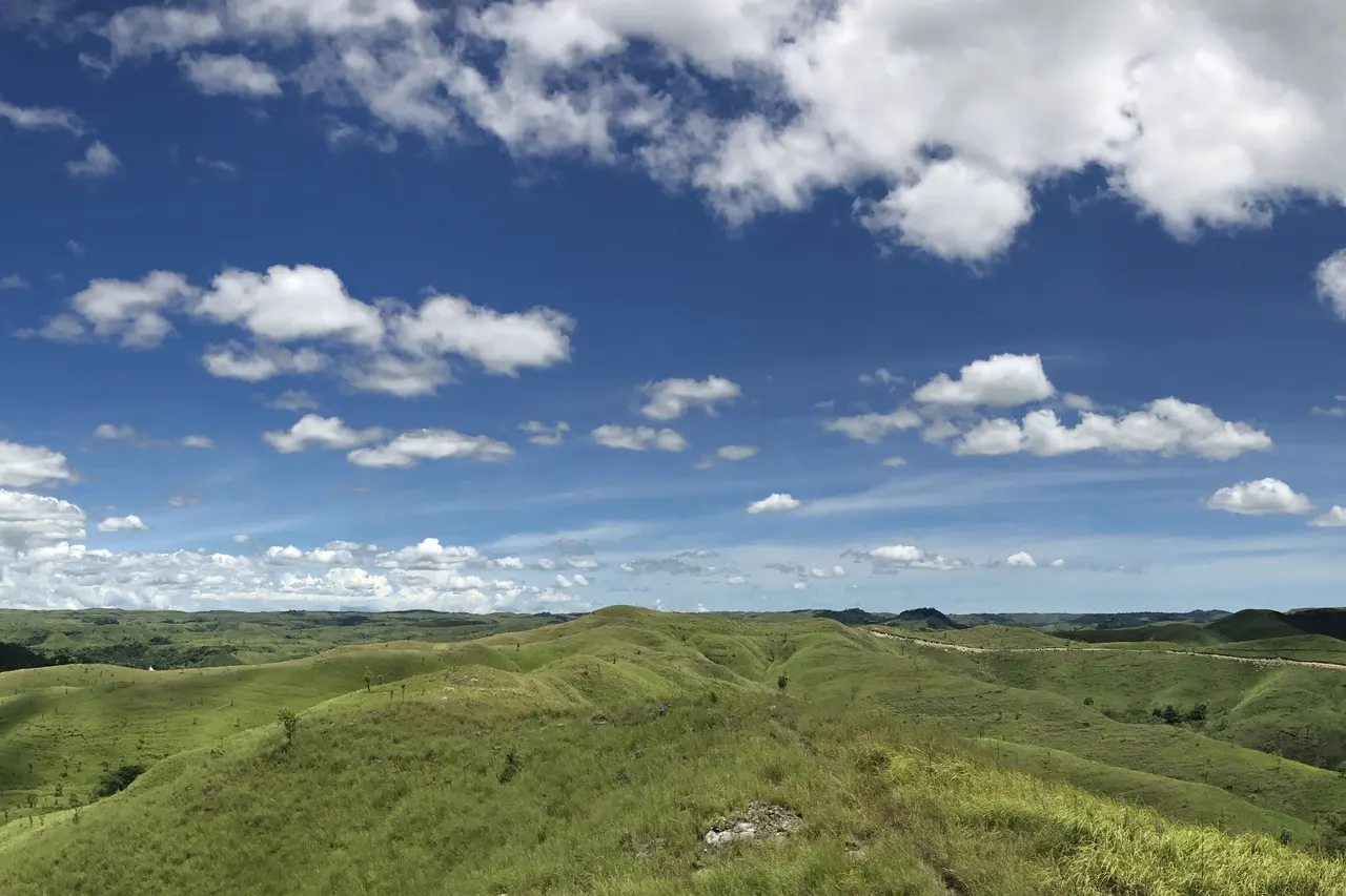
On Sumba the road is part of the trip. It climbs from the coast into rolling grassland, drops into valleys of rice and palms, and passes villages where high-roofed clan houses stand around stone tombs. Horses and buffalo wander across the asphalt, children wave from school yards, and for long stretches yours is the only car. It is beautiful, and it is slow: Sumba is about 200 km long, roughly twice the size of Bali, and the distances on the map always take longer than you think.
The short answer: the easiest way to get around Sumba is a rented car with a local driver, which costs roughly IDR 600,000-1,000,000 a day. Scooters suit confident riders with the right licence, and public buses link the main towns but are slow and irregular. Allow about 4-5 hours to drive between Tambolaka in the west and Waingapu in the east, avoid driving after dark, fill up whenever you see a proper petrol station, and download offline maps before you leave town.
Your options at a glance
Car with a local driver (recommended)
This is what most visitors do, and for good reason. Road signs are few, villages are reached by unmarked turns, and a local driver knows which roads are passable, when ceremonies are on and how to introduce you politely in a village. Expect roughly IDR 600,000-1,000,000 a day in 2025-2026; some international guides quote around USD 75. Ask whether fuel, the driver's meals and his room on overnight trips are included, and agree the plan and the price the evening before. Hotels and homestays can find drivers, and in high season (June to August) it is wise to book ahead.
Low Tide, every Sunday
One short letter a week about living well, from an island with more horses than traffic lights. Free.
We only use your email to send the letter. Unsubscribe in one click.Scooter
Scooters cost roughly IDR 150,000-200,000 a day in Tambolaka and Waingapu in 2025-2026, and in August they can be fully booked two weeks ahead. Fleets are older than in Bali: check brakes, lights, tyres and horn before you leave. Riding is rewarding on the quiet coastal roads of the west, but long cross-island days are tiring, surfaces change quickly from smooth asphalt to gravel, sand or mud, and many waterfalls and beaches are at the end of rough tracks.
Self-drive car
Available in a few places, roughly IDR 400,000-650,000 a day without fuel. Only worth it if you are an experienced driver comfortable navigating with offline maps, and you must carry an International Driving Permit.
Buses, minibuses and shared cars
Public transport runs between the main towns. Older listings show a daily early-morning bus from Waitabula (Tambolaka) to Waingapu via Waikabubak and Lewa taking about 6 hours, with faster shared "travel" minibuses leaving when full; minibuses from Waitabula to Waikabubak take about 1.5 hours and to Kodi about 1 hour. Buses from Waikabubak to Waingapu take about 4.5 hours. Fares are low (tens of thousands of rupiah) but schedules are loose, there is little service in the evening, and buses do not go to most beaches or villages. Ojek motorbike taxis cover short hops, and can be hired by the day.
Real driving times between the main points
The table gives approximate road distances (from OpenStreetMap routing, rounded) and realistic driving times by car in the dry season, based on local reports and bus timings. Travel apps tend to underestimate: add time for photo stops, livestock, roadworks and rain.
| Route | Distance | Driving time |
|---|---|---|
| Tambolaka to Waikabubak | about 40 km | 1-1.5 h |
| Tambolaka to Kodi (Bondo Kodi) | about 40 km | 1-1.5 h |
| Tambolaka to Weekuri Lagoon | about 40-60 km depending on route | 1-1.5 h |
| Kodi to Weekuri Lagoon | about 20 km | 30-45 min |
| Waikabubak to Kodi | about 75 km | about 2 h |
| Waikabubak to Waingapu | about 130 km | 3.5-4.5 h |
| Tambolaka to Waingapu | about 170 km | 4-5 h |
| Waingapu to Wairinding hill | about 25 km | 30-45 min |
| Waingapu to Walakiri beach | about 22-24 km | 30-45 min |
| Waingapu to Tanggedu waterfall | about 50 km | 1.5-2 h, then a walk |
| Waingapu to Tarimbang beach | about 85-90 km | 3-4 h, last stretch slow |
| Wairinding to Waikabubak | about 110 km | 3-4 h |
The main east-west road runs Tambolaka, Waikabubak, Waibakul, Lewa and Waingapu. Lewa is roughly halfway, and the road to Tarimbang turns south just east of it. Tanggedu ends with a dirt and rock road and a walk of up to 30 minutes each way (local riders offer lifts for the last part). For what to see along the way, read our guide to beaches, lagoons and waterfalls, and for how to string it all together, our 5, 7 and 10-day itineraries.
Road conditions and seasons
Traffic is light, and the main trans-Sumba road and the northern coastal road in the west are mostly asphalt. Away from them, conditions change fast: potholes, gravel, sand, steep hills and narrow bridges. Many roads to beaches and villages are dirt tracks, and some are passable only when dry. Expect goats, cows, horses, dogs and vehicles in the wrong lane.
In the rainy season (roughly November/December to March) some routes flood or turn to mud, and a few can become close to impassable; in the dry season (roughly May to September, into November in the east) everything is easier. Check our guide to the best time to visit Sumba. Whatever the season, the simplest plan is to fly into one airport and out of the other, so you cross the island only once; see how to get to Sumba from Bali.
Night driving
Avoid it. There is little or no street lighting outside the towns, animals sleep on warm asphalt, potholes are invisible, and if you break down there may be no signal. Travel guides have also long advised against travelling after dark in remote parts of West and Southwest Sumba, including the Kodi area, and local drivers generally prefer to be home by nightfall. Plan long transfers to finish by late afternoon (sunset is around 18:00 WITA most of the year), and note that some sights, such as Weekuri Lagoon, have closed around 17:00. More advice in our Sumba safety and health guide.
Fuel: prices, shortages and limits
Petrol stations (SPBU) are found in and around the towns and are few and far between elsewhere. Fill up whenever you pass a proper station.
- Prices: in November 2026 Pertalite, the subsidised standard petrol, cost IDR 10,000 a litre at the pump; Pertamax, the higher grade, IDR 15,950.
- Roadside sellers: in villages, petrol is sold in bottles at kiosks. It is fine in an emergency, but costs more: in Waingapu in October 2026 a 1.5-litre bottle went for about IDR 20,000, and quality varies.
- Shortages and queues: Sumba has repeated bouts of fuel queues. In mid-October 2026, deliveries to stations in Waingapu were cut from about 16,000 to 8,000 litres per fuel type per day, and queues spilled onto the main road. Authorities blame in part resellers who buy subsidised fuel to resell, and in 2024 the four regencies agreed to adjust quotas and ban buying subsidised fuel for resale. Since late October 2026 the local government in the west has also capped Pertalite and Pertamax purchases at 5 litres per motorbike and 15 litres per car (see our report).
- Limits: subsidised Pertalite for cars is tied to Pertamina's QR-code registration, which rental drivers handle. If queues are long, the non-subsidised Pertamax line is often quicker. Never let your tank fall below half before a remote stretch.
Licence: the International Driving Permit
To drive or ride in Indonesia, foreigners need their national licence plus an International Driving Permit (IDP) issued in their home country. Indonesia follows the 1949 Geneva Convention format, and the IDP must cover the right category: A for motorcycles and scooters, B for cars. A car-only licence does not cover a 125 cc scooter. Police can fine on the spot, roughly IDR 300,000-500,000 for each missing document, and helmets are compulsory. More importantly, travel insurers may refuse to pay medical bills after an accident if you were not licensed for that vehicle. Many rental shops never ask for the IDP: that does not make riding without one legal.
Maps, apps and mobile coverage
- Download offline maps (Google Maps offline areas, or an app such as Maps.me or OsmAnd) for the whole island before you leave a town with Wi-Fi. Mobile data disappears in many hills and valleys.
- Use car mode even on a scooter: Google's car routes tend to stay on better roads, while motorbike routes can send you down tracks.
- Add time: journeys often take longer than Google Maps suggests.
- Get a Telkomsel SIM: it has the widest coverage in Sumba, while other networks are weaker outside the towns. Buy it in Bali, and remember that coverage is still patchy, especially in the central and eastern interior and at places like Tanggedu.
- No ride-hailing: there are no Grab or Gojek cars as in Bali, and no metered taxis; agree prices before every ride.
- Save numbers: keep your driver's and your accommodation's numbers on paper too, in case your phone dies.
Respect on the road
Slow down through villages, where children and animals share the road. If a funeral or ceremony blocks the way, wait patiently. Ask your driver before stopping to photograph people or houses, and leave a donation when you visit a village. Our guide to Marapu, ikat and traditional villages explains the etiquette, and if you are wondering what all this costs, read how much a trip to Sumba costs.
Frequently asked questions
How long does it take to drive from Tambolaka to Waingapu?
About 4-5 hours by car for roughly 170 km on the main trans-Sumba road via Waikabubak and Lewa. Public buses take around 6 hours. Allow more time in the rainy season and for stops.
Is it safe to rent a scooter in Sumba?
It is possible for experienced riders, but roads change quickly from asphalt to gravel, sand or mud, animals wander onto the road, and distances are long. You legally need your national motorcycle licence plus an International Driving Permit with category A, and a helmet; without them your travel insurance may not pay after an accident.
Is there Grab or Gojek in Sumba?
No. There are no ride-hailing cars and no metered taxis as in Bali. Arrange a driver through your accommodation, use ojek motorbike taxis for short hops, and agree every price in advance.
Can I drive at night in Sumba?
It is best avoided. There are few street lights outside the towns, animals rest on the road, potholes are hard to see and signal can be absent. Travel guides also advise against travelling after dark in remote parts of West and Southwest Sumba, including the Kodi area.
Is there a fuel shortage in Sumba?
Fuel queues are recurrent. In October 2026, supply to stations in Waingapu was cut by about half for several days and queues spilled onto the road. Fill up whenever you pass a station, and use roadside bottle sellers only in an emergency.
Does Google Maps work in Sumba?
Yes in towns, but mobile data disappears in many hills and valleys. Download offline maps for the whole island, use car mode even on a scooter, and expect journeys to take longer than Google estimates.
Places in this guide
- Tambolaka · Southwest Sumba · Open in maps
- Tambolaka Airport (TMC) · Southwest Sumba · Open in maps
- Waikabubak · West Sumba · Open in maps
- Bondo Kodi · Southwest Sumba · Open in maps
- Weekuri Lagoon · Southwest Sumba · Open in maps
- Waingapu · East Sumba · Open in maps
- Waingapu Airport (WGP, Umbu Mehang Kunda) · East Sumba · Open in maps
- Wairinding hill · East Sumba · Open in maps
- Walakiri beach · East Sumba · Open in maps
- Tarimbang · East Sumba · Open in maps
- How to get to Waitabula (Tambolaka): buses, minibuses, ferry, Travelfish, accessed Nov 2026
- How to get to Waikabubak, Travelfish, accessed Nov 2026
- Sumba Motorbike Rental: What to Know First, Backindo, 4 Oct 2025 (updated Jul 2026)
- Pasokan BBM di Waingapu Sumba Timur terbatas, antrean kendaraan meluber ke jalan, iNews/RCTI+, 16 Oct 2026
- Pemkab sepulau Sumba sepakat keluarkan edaran penyesuaian kuota BBM, ANTARA Kupang, 10 Aug 2024
- International driving licence for Bali and Indonesia, Bali.com, updated Jul 2026
- Terkagum melihat lanskap Bukit Wairinding, Good News From Indonesia, 7 Feb 2025
- Pantai Tarimbang Sumba Timur, detikBali, 16 Aug 2024
Spotted an error? Write to info@ecobeachcity.com.
Low Tide, every Sunday
One short letter a week about living well, from an island with more horses than traffic lights. Free.
We only use your email to send the letter. Unsubscribe in one click.