Place · Travel
Melolo, Sumba: the old Savunese town of the south-east
Horse races on the sand at low tide, carved tombs in the river delta and some of Sumba's oldest archaeological finds: Melolo, gateway to East Sumba's royal villages.
Melolo is a small town in Umalulu district, East Sumba, roughly 60 km south-east of Waingapu (a little over 2 hours by public bus, less by car). Founded as a Savunese settlement in the 18th century, it is the gateway to the traditional villages of Pau, Umbara and Rende (Praiyawang). Its beach hosts evening horse riding and, at low tide, horse races; do not swim near the river, which has crocodiles.
- Where
- Umalulu district (Lumbukore), south-east coast of East Sumba
- From the nearest airport
- Waingapu (WGP): roughly 60 km; a little over 2 hours by bus, less by car
- Best time
- Dry season; late afternoon at low tide for the horses
- Entry
- Free; it is a town (donations in nearby villages)
- Good for
- Base for Pau, Umbara and Rende; horse riding on the beach
Late afternoon, and the tide has gone out so far that the beach is a wide grey-gold plain. Riders appear from the palms, boys and young men on small, quick Sumba ponies, and soon there are horses galloping along the wet sand, spray flying, shouts carried away by the wind. Behind them the town goes about its evening: shops closing, buses heading back to Waingapu.
Melolo is not a beauty spot. It is a crossroads with a long history, and the best base for East Sumba's great traditional villages.
What it is and why go
Melolo lies in Umalulu district on the south-east coast of East Sumba; OpenStreetMap places it in Lumbukore. The Spice Route End travel blog describes it as an old settlement of Savunese (people from the island of Savu) dating back to the 18th century, within the traditional domain of Umalulu. Today it is a market and transport town on the road from Waingapu to the south-east.
Sumba this week, every Sunday
The week's news, one place worth the trip and practical travel notes. Free, and you get our 7-day Sumba guide (PDF) on signing up.
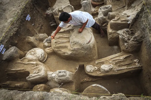
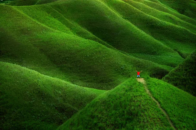
One email a week. No spam. Unsubscribe in one click. Sumba this weekThe Sumba Information guide notes that the beach is used for evening horse riding and for Saturday horse races at low tide, and that crocodiles live in the nearby river. Melolo is also an archaeological site: in 2024 detikInet reported research by Indonesia's national research agency BRIN that found 26 human skeletons and carved vessels at Melolo, among the oldest evidence of settlement on Sumba (the study's headline date for the island is at least 2,800 years ago). On the way here, the Jakarta Post noted in 2019, the road crosses golden meadows typical of the dry east.
How to get there
- From Waingapu (WGP): roughly 60 km south-east by road. The Spice Route End took a public bus from Waingapu in 2018, paying IDR 20,000 for a trip of a little over 2 hours; by car it is quicker.
- Buses: the same source says eastbound buses run along Melolo's main street in the morning (around 07:00-08:00 at the time).
- From Tambolaka (TMC): a full day's drive; fly into Waingapu instead.
When to go and best time of day
The dry season (roughly May-November in the east) is easiest for the side roads to the villages. For the beach, come in the late afternoon at low tide; Sumba Information mentions races on Saturdays. Mornings are best for village visits, when it is cooler and people are at home.
Tips and etiquette
- No swimming near the river: Sumba Information warns of crocodiles in the river near the beach.
- Horses: keep a safe distance from galloping horses and never walk across a race line. Ask before photographing riders.
- Villages: Pau, Umbara and Rende are living Marapu villages. Sign the guest book, leave a donation (around IDR 10,000-40,000 per person is common, 2025-2026), dress modestly and ask before photos. In 2018 the Spice Route End's guide and driver were given IDR 20,000 for cigarettes as a courtesy.
- Cash: bring enough from Waingapu.
Plan your visit
Melolo works best as the centre of a full day in the south-east: leave Waingapu early, visit Pau and Umbara in the delta in the morning and Rende (Praiyawang) late in the morning, have lunch in Melolo, then either continue south to the weavers of Kaliuda or turn inland to Waimarang waterfall. Come back to the beach in the late afternoon if the tide is low and you want to see the horses. The Spice Route End found simple homestays in the town in 2018, so it is possible to stay overnight and split the long south-east loop into two easier days.
Nearby
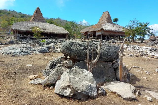
- Pau and Umbara, traditional villages in the Melolo river delta, reached just before the Melolo bridge.
- Rende (Praiyawang), about 7 km south of Melolo, with great stone tombs.
- Kaliuda, the weaving village further south.
- Waimarang waterfall, inland, a classic day trip from Waingapu that passes Melolo.
Frequently asked questions
How far is Melolo from Waingapu?
Roughly 60 km south-east. A public bus took a little over 2 hours in 2018; a car is faster.
When are the horse races on Melolo beach?
Sumba Information mentions races on Saturdays at low tide and evening riding on other days. Ask locally, as timing depends on the tide.
Can you swim at Melolo?
Not near the river: Sumba Information warns of crocodiles there.
Places in this guide
- Melolo · Umalulu, East Sumba · Open in maps
Distances by road
Melolo is in Umalulu, East Sumba, on the island of Sumba, Indonesia: 233 km by road from Tambolaka Airport (TMC) (about 5 h 35 min to 6 h 50 min) and 58 km from Waingapu Airport (WGP) (about 1 h 20 min to 1 h 40 min).
- Regency
- East Sumba (Sumba Timur)
- From Tambolaka Airport (TMC)
- 233 km by road, about 5 h 35 min to 6 h 50 min driving
- From Waingapu Airport (WGP)
- 58 km by road, about 1 h 20 min to 1 h 40 min driving
- Nearest town
- Waingapu: 63 km by road, about 1 h 30 min to 1 h 50 min
- Coordinates
- -9.8846, 120.6636 · Open in Google Maps ·
- Sunrise and sunset
- Sunrise from 05:25 (November) to 06:15 (July); sunset from 17:43 (May) to 18:25 (January), local time (WITA). Calculated for these coordinates on the 15th of each month.
Combine it in one day. The closest places by road from here, with the driving time between them:
- Pau village4.4 km · 5 min to 10 min
- Rende village7.4 km · 10 min to 15 min
- Waimarang Waterfall15 km · 20 min to 25 min
Road distances were calculated on 18 November 2026 with the OSRM routing engine on OpenStreetMap roads. Driving times are our estimate at an average of 34 to 42 km/h without long stops, the pace at which the 170 km between Tambolaka and Waingapu take 4 to 5 hours. All distances between towns and places →
Nearby places
- Pau village3 km straight-line
- Rende village6 km straight-line
- Waimarang Waterfall11 km straight-line
- Danau Laipori33 km straight-line (map point approximate)
Straight-line distances between map points; roads are longer. Getting around Sumba: car with driver, scooter, buses and real driving times
- Sumba: around Waingapu and Melolo, The Spice Route End (travel blog), 2018
- The Southeast of Sumba, Sumba Information (Melolo beach, horse races, crocodiles), accessed Nov 2026
- Peneliti BRIN ungkap Pulau Sumba dihuni manusia sejak 2.800 tahun lalu, detikInet, 17 Jul 2024
- East Sumba and its unforgettable beauty, The Jakarta Post, 3 Jul 2019
- Melolo, OpenStreetMap / Nominatim (coordinates)
Spotted an error? Write to info@ecobeachcity.com.
Sumba this week, every Sunday
The week's news, one place worth the trip and practical travel notes. Free, and you get our 7-day Sumba guide (PDF) on signing up.
One email a week. No spam. Unsubscribe in one click. Sumba this week