Place · Travel
Wunga, Sumba: the village of beginnings on the north coast
In Sumbanese tradition the ancestors first came ashore in Haharu, and Wunga is called East Sumba's oldest village: what is there, and how to visit with care.
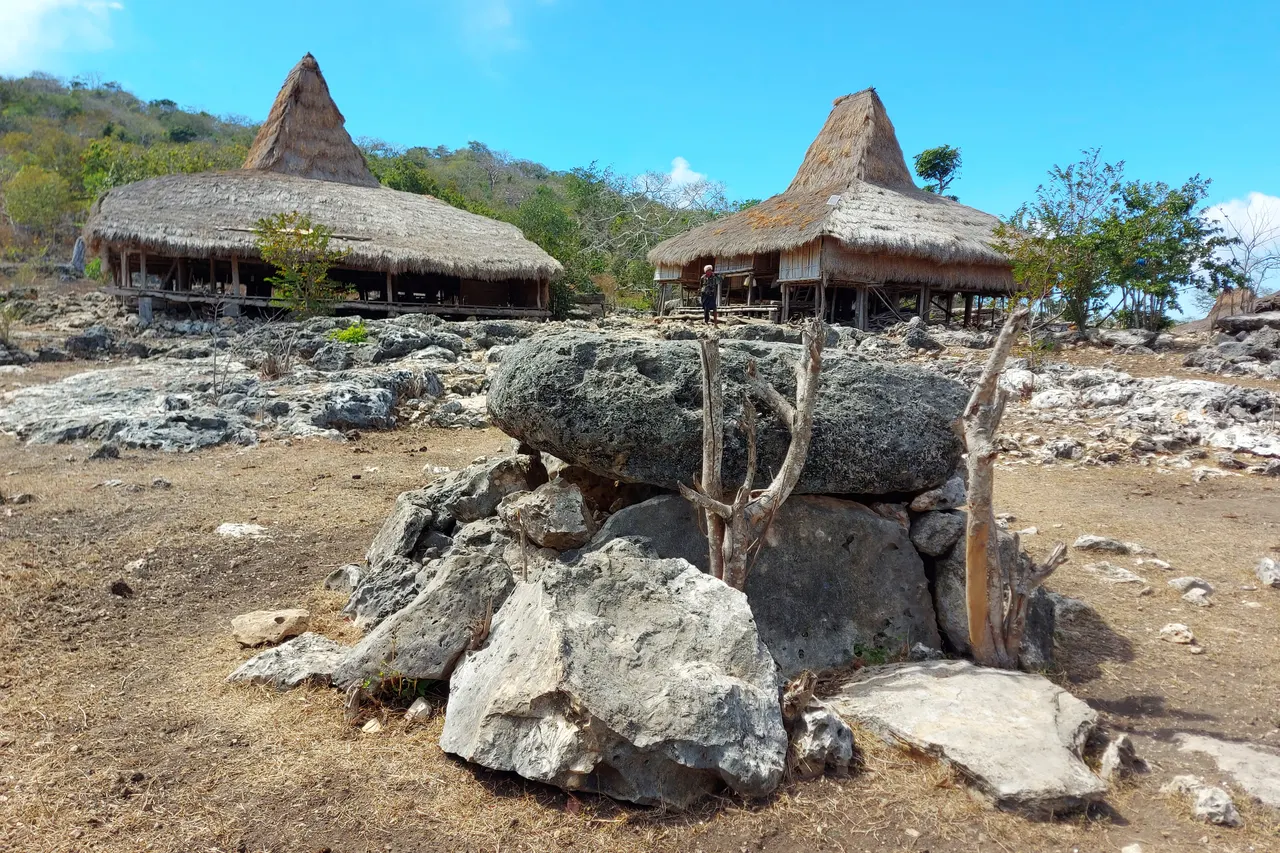
Kampung Wunga is a Marapu village in Wunga village, Haharu district, on the far north coast of East Sumba, about 65 km from Waingapu. Times Indonesia calls it the oldest village in East Sumba, its name linked to the idea of a beginning, and it keeps old megalithic graves and clan rituals. It is not developed for tourism: go only with a local guide, ask permission and keep your visit low-key.
- Where
- Wunga village, Haharu district, north coast of East Sumba
- From the nearest airport
- Waingapu (WGP): about 65 km, roughly 1.5-2 hours by car
- Best time
- Dry season; mornings, outside rituals
- Entry
- No ticket; permission, guest book and donation
- Good for
- Marapu heritage, old megalithic graves, a quiet north coast
The road north from Waingapu runs through dry grassland and scattered lontar palms, the sea glinting on the right, the land growing emptier with every kilometre. At the end, on higher ground near the tip of the island, stands a village of thatched houses and weathered stones. Wind from the strait. Dogs, a few children, an old man watching. It is a quiet place, and in Sumbanese memory one of the oldest.
Wunga is not a sight in the usual sense. It is a living community with a special place in the island's story, and it should be visited as a guest.
What it is and why go
Times Indonesia (October 2023) describes Kampung Wunga, in Wunga village, Haharu district, East Sumba Regency, as the first and oldest village in East Sumba, standing on higher ground at the northern tip of the island. The name, the article says, comes from Kawunga, linked to the idea of a beginning. Most residents follow Marapu, the ancestral belief of Sumba, and clans (kabihu) such as Matolang, Pahoka, Tula Parenga Waimoru, Uma Ratu and Analingu lead rituals such as hamayang (prayer) and ceremonies for deaths and great feasts. The village keeps megalithic graves that the article calls among the oldest of the Sumbanese tradition, and it has not been developed as a tourist destination.
Sumba this week, every Sunday
The week's news, one place worth the trip and practical travel notes. Free, and you get our 7-day Sumba guide (PDF) on signing up.
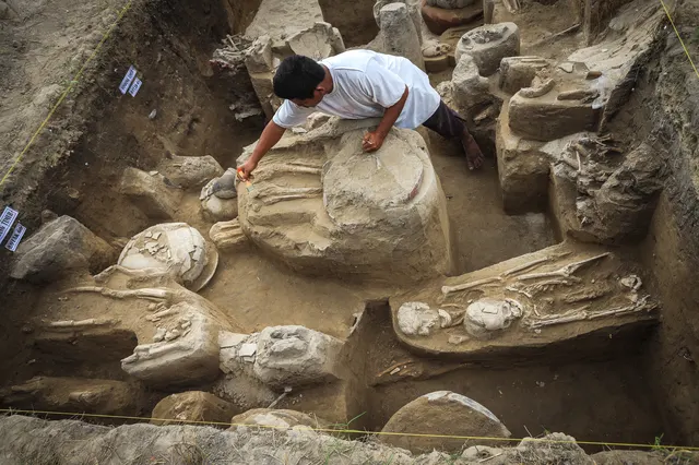
One email a week. No spam. Unsubscribe in one click. Sumba this weekArchaeology adds context. In 2024 detikInet reported on BRIN research at Mborombaku, near the Kadahang river in the same Haharu district, where the ancestors of the Sumbanese may have first landed; finds there include 13th-century Yuan-dynasty celadon from Fujian, and the site was dated to about 1,300 years ago. Read Marapu, ikat and traditional villages before you go.
How to get there
- From Waingapu (WGP): about 65 km north-west (Times Indonesia). Allow roughly 1.5-2 hours by car each way, more if the last stretch is rough.
- From Tambolaka (TMC): not practical as a trip from the west.
Go by car with a driver and, ideally, a guide who has contacts in the village and can ask permission on your behalf. There is no tourist infrastructure. The map point on this page marks Wunga village as mapped on OpenStreetMap.
When to go and best time of day
The dry season (roughly May-November in the east) makes the north-coast road easier. The north of East Sumba is among the driest parts of the island; carry water and expect strong sun and wind. Go in the morning, and ask your guide whether any ritual or funeral is under way; if so, it may be better to come another day.
Tips and etiquette
- Permission first: do not walk in unannounced. Let your guide speak to the elders, and accept a no.
- Donation and gifts: sign any guest book and leave a donation (around IDR 10,000-40,000 per person is common in Sumbanese villages, 2025-2026). Betel nut (sirih pinang) is a traditional gift.
- Sacred places: do not touch graves, house posts, offerings or ritual objects, and do not enter houses unless invited.
- Photos and drones: ask first, every time. Many villagers prefer not to be photographed during rituals.
- Dress modestly and keep the visit short and quiet.
Plan your visit
Wunga is a long half day from Waingapu. Combine it with the north coast: leave early, visit Wunga in the morning with your guide, and stop at the savanna and beach of Puru Kambera on the way back in the afternoon. Tanggedu waterfall is also in the north but usually a separate trip. Bring food and water, because shops are few along this road, and allow time for conversation: in a village like Wunga, the real visit is the talk with the elders, not the photographs.
Nearby
- Tanggedu waterfall, in the north of East Sumba, a separate half-day trip.
- Puru Kambera, savanna and beach on the north coast closer to Waingapu.
- Waingapu, the base for East Sumba.
- East Sumba Regency, our overview of the region.
Frequently asked questions
Why is Wunga called the oldest village in East Sumba?
Times Indonesia reports that local tradition regards it as the first village of East Sumba; its name comes from Kawunga, linked to the idea of a beginning. Research by BRIN nearby in Haharu points to an area where ancestors may have first landed.
Can tourists visit Kampung Wunga?
Yes, respectfully, but it is not set up for tourism. Go with a local guide who can ask the elders for permission.
How far is Wunga from Waingapu?
About 65 km, roughly 1.5-2 hours by car each way.
Places in this guide
- Wunga · Haharu, East Sumba · Open in maps
Distances by road
Wunga is in Haharu, East Sumba, on the island of Sumba, Indonesia: 144 km by road from Tambolaka Airport (TMC) (about 3 h 25 min to 4 h 15 min) and 69 km from Waingapu Airport (WGP) (about 1 h 40 min to 2 h).
- Regency
- East Sumba (Sumba Timur)
- From Tambolaka Airport (TMC)
- 144 km by road, about 3 h 25 min to 4 h 15 min driving
- From Waingapu Airport (WGP)
- 69 km by road, about 1 h 40 min to 2 h driving
- Nearest town
- Waingapu: 62 km by road, about 1 h 30 min to 1 h 50 min
- Coordinates
- -9.3692, 119.9636 · Open in Google Maps ·
- Sunrise and sunset
- Sunrise from 05:29 (November) to 06:17 (July); sunset from 17:47 (May) to 18:27 (January), local time (WITA). Calculated for these coordinates on the 15th of each month.
Combine it in one day. The closest places by road from here, with the driving time between them:
- Puru Kambera31 km · 45 min to 55 min
- Tanggedu Waterfall40 km · 1 h to 1 h 10 min
Road distances were calculated on 18 November 2026 with the OSRM routing engine on OpenStreetMap roads. Driving times are our estimate at an average of 34 to 42 km/h without long stops, the pace at which the 170 km between Tambolaka and Waingapu take 4 to 5 hours. The mapped road ends about 0.8 km from this point: the last stretch is a track or a walk. All distances between towns and places →
Nearby places
- Puru Kambera23 km straight-line
- Tanggedu Waterfall27 km straight-line
- Wairinding Hill38 km straight-line
- Londa Lima Beach38 km straight-line
Straight-line distances between map points; roads are longer. Getting around Sumba: car with driver, scooter, buses and real driving times
- Eksplorasi budaya megalitik di Pulau Sumba, kampung adat tertua dan penuh sejarah, Times Indonesia, 14 Oct 2023
- Peneliti BRIN ungkap Pulau Sumba dihuni manusia sejak 2.800 tahun lalu, detikInet, 17 Jul 2024
- Wunga, Kecamatan Haharu, OpenStreetMap / Nominatim (coordinates)
Spotted an error? Write to info@ecobeachcity.com.
Sumba this week, every Sunday
The week's news, one place worth the trip and practical travel notes. Free, and you get our 7-day Sumba guide (PDF) on signing up.
One email a week. No spam. Unsubscribe in one click. Sumba this week