Guide · Travel
Where is Sumba island? Location, distances and Sumbawa mix-up
Sumba is in East Nusa Tenggara, south of Flores and about 450 km east of Bali. Here are its neighbours, distances, flight times and why it is not Sumbawa.
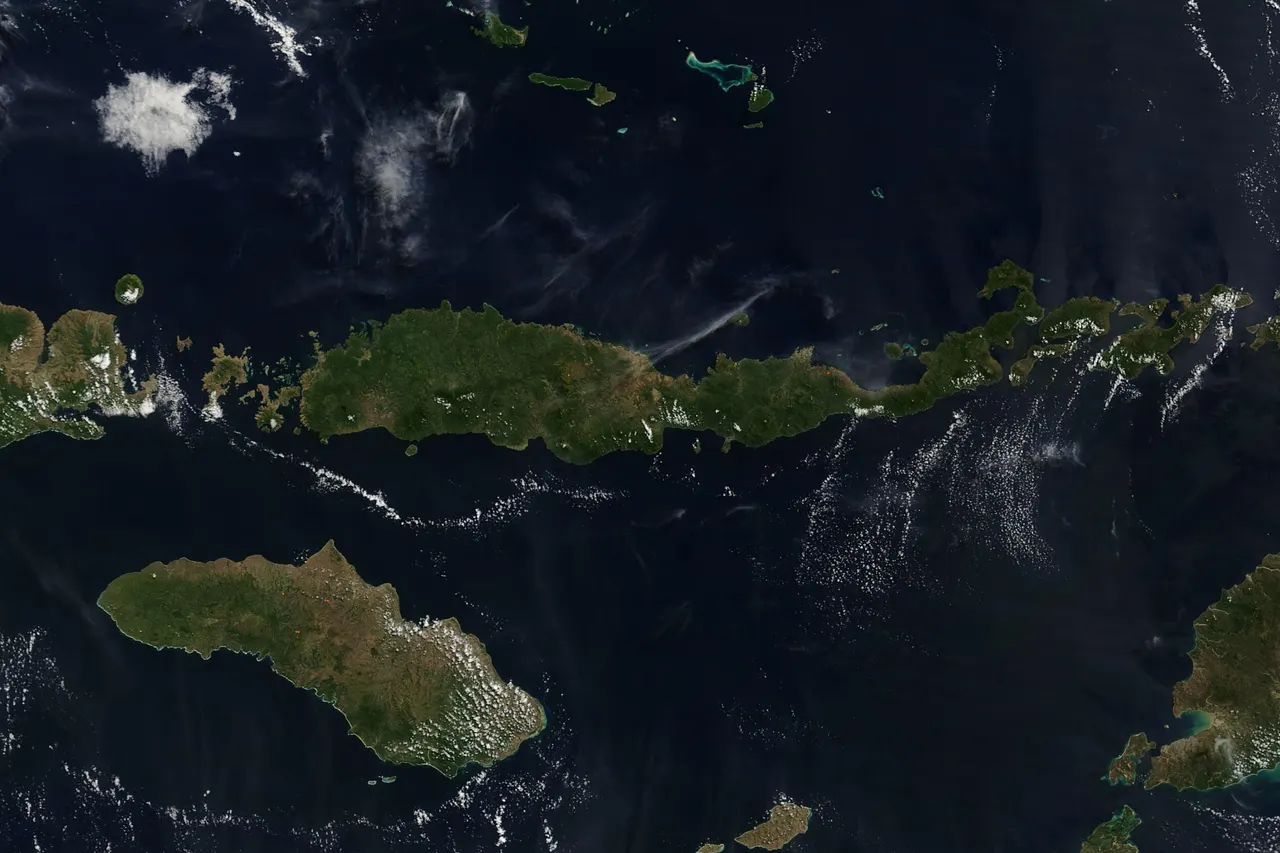
Sumba is an Indonesian island in the province of East Nusa Tenggara, in the Lesser Sunda Islands, south of Flores and about 450 km east of Bali in a straight line. It is roughly twice the size of Bali, is divided into four regencies and uses Central Indonesia Time (WITA, UTC+8), the same as Bali. It is often confused with Sumbawa, a different and larger island to the north-west that belongs to West Nusa Tenggara.
- Country and province
- Indonesia, East Nusa Tenggara (NTT)
- Neighbours
- Sumbawa (north-west), Flores (north-east), Timor (east), Indian Ocean (south)
- Distance from Bali
- About 450 km in a straight line; flight of 1 to 1.5 hours
- Size
- About 11,000 km², roughly twice Bali; about 210 km long
- Regencies
- 4: Southwest, West, Central and East Sumba
- Time zone
- WITA, UTC+8, same as Bali
- Not to be confused with
- Sumbawa, a larger island in West Nusa Tenggara (NTB)
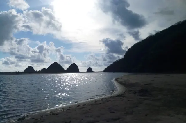
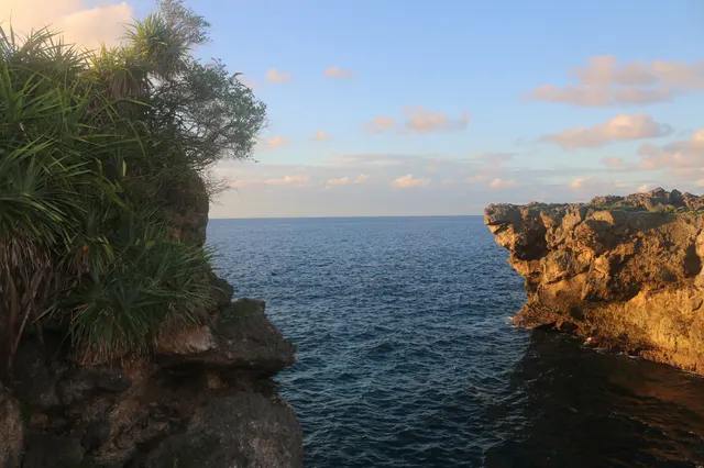
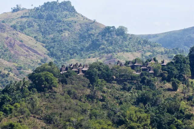
From the plane window, an hour out of Bali, the sea runs out and a long brown-and-green island slides under the wing: pale limestone cliffs, folded hills of grass, hardly a town in sight. That is Sumba. Many travellers who land here could not have placed it on a map a month earlier, and a fair number first searched for it under the name of another island.
The short answer: Sumba is in eastern Indonesia, in the province of East Nusa Tenggara (Nusa Tenggara Timur, NTT). It lies south of Flores, south-east of Sumbawa and about 450 km east of Bali. It is not Sumbawa, and the difference matters when you book a flight.
Where Sumba is on the map
Indonesia's Lesser Sunda Islands run east from Bali in a chain: Lombok, Sumbawa, Flores and onwards. Sumba sits just south of that chain, slightly apart, at about 9 to 10 degrees south of the equator and 120 degrees east. Its neighbours are:
Sumba this week, every Sunday
The week's news, one place worth the trip and practical travel notes. Free, and you get our 7-day Sumba guide (PDF) on signing up.
One email a week. No spam. Unsubscribe in one click. Sumba this week- North-west: Sumbawa.
- North-east: Flores, across the Sumba Strait (Selat Sumba).
- East: Timor, across the Savu Sea.
- South: the open Indian Ocean, and beyond it Australia.
That position explains a good deal. The south and west coasts face ocean swell with nothing in the way, which is why the island has surf and strong currents. And because Sumba is off the main volcanic chain, it has no volcanoes: its highest point is Mount Wanggameti, at 1,225 m, and its landscape is limestone and savanna.
Province, regencies and towns
Sumba belongs to East Nusa Tenggara, the province that also includes Flores, West Timor and the Komodo area. The provincial capital is Kupang, on Timor. The island is divided into four regencies (kabupaten):
| Regency | Capital | Area | People (BPS, mid-2025) |
|---|---|---|---|
| Southwest Sumba | Tambolaka | 1,381.94 km² | 335,500 |
| West Sumba | Waikabubak | 737.42 km² | 160,170 |
| Central Sumba | Waibakul | 1,789.69 km² | 94,187 |
| East Sumba | Waingapu | 7,000.5 km² | 262,975 |
East Sumba alone covers almost two thirds of the island but is thinly populated. The west is small, green and crowded by comparison. The largest town is Waingapu, on the north-east coast, followed by Tambolaka and Waikabubak in the west.
How big is Sumba?
Sources give between roughly 10,900 and 11,250 km², depending on whether offshore islets are counted. The simple version: Sumba is about twice the size of Bali (5,582.83 km²) and, as Wikipedia notes, about the same size as Jamaica. It stretches about 210 km from west to east and about 115 km from north to south. An estimated 852,832 people lived there in mid-2025. More numbers are in Sumba in facts and figures.
Distances and flight times
Straight-line distances below are our own calculation between airport coordinates, rounded. Flight times are the typical non-stop times listed on our flights page, checked on 10 November 2026.
| From | Straight-line distance | Flight |
|---|---|---|
| Bali (Denpasar) to Tambolaka | about 450 km | Non-stop, about 1 h to 1 h 15 |
| Bali (Denpasar) to Waingapu | about 570 km | Non-stop, about 1 h 20 to 1 h 25 |
| Kupang to Waingapu | about 370 km | Non-stop, about 1 h 15 |
| Labuan Bajo (Flores) to Tambolaka | about 125 km | Non-stop, about 50 min, seasonal |
| Jakarta to Tambolaka | about 1,430 km | No direct flight: about 2 h to Bali, then the Sumba flight |
| Darwin (Australia) to Waingapu | about 1,200 km | No direct flight: about 2.5-3 h to Bali, then the Sumba flight |
Sumba has no international flights, so every route passes through an Indonesian city, usually Bali. From Jakarta, a smooth connection takes roughly 5-8 hours airport to airport. Darwin is close on the map, closer than Jakarta, but there is no direct flight: Australians fly to Bali first. Route guides: from Bali, from Jakarta, from Australia, from Kupang and from Labuan Bajo.
The island has two airports about 120 km apart in a straight line and about 170 km by road, a drive of 4-5 hours: Tambolaka (TMC) in the north-west and Waingapu (WGP) in the east.
Time zone
Sumba uses Central Indonesia Time (WITA), which is UTC+8. That is the same time as Bali, Lombok and Flores, and the same as Perth. Jakarta and Java are one hour behind, on Western Indonesia Time (WIB, UTC+7). There is no daylight saving. If you connect in Bali, you do not change your watch.
Sumba vs Sumbawa: two different islands
The names differ by two letters and the islands are neighbours, so the confusion is constant, in search engines, on booking sites and occasionally at check-in desks. They are separate islands in separate provinces, with different landscapes, religions and airports.
| Sumba | Sumbawa | |
|---|---|---|
| Province | East Nusa Tenggara (NTT) | West Nusa Tenggara (NTB), with Lombok |
| Position | South of Flores, off the main island chain | Between Lombok (west) and Flores (east) |
| Area | About 11,000 km² | About 15,448 km² |
| Population | About 853,000 (mid-2025) | About 1.67 million (mid-2024) |
| Highest point | Mount Wanggameti, 1,225 m, not a volcano | Mount Tambora, 2,850 m, the volcano of the 1815 eruption |
| Main towns | Waingapu, Tambolaka, Waikabubak | Bima, Sumbawa Besar |
| Main religion | Christian majority, with Marapu ancestral belief | Muslim majority |
| Airports for visitors | Tambolaka (TMC), Waingapu (WGP) | Bima is the main one |
| Known for | Savanna, megalithic villages, Pasola, ikat | Tambora, surf, the road from Lombok to Flores |
Sumba lies south-east of Sumbawa, and the two are linked by sea: the ferry between Waikelo, near Tambolaka, and Sape, on the eastern tip of Sumbawa, reopened on 24 May 2026 (see ferries to Sumba).
How not to book the wrong island: check the airport code. Sumba is TMC or WGP. If a search result shows Bima or Sumbawa Besar, you are looking at Sumbawa. And if a hotel address ends in "NTB", it is not on Sumba.
Other names you may see
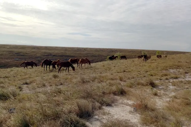
In the island's own languages Sumba is called Humba or Hubba. Older books call it Sandalwood Island, after the sandalwood it once exported; those forests are now largely gone, though the name survives in the Sandalwood pony. The people are the Sumbanese, who speak several related languages, including Kambera in the east and Kodi in the far west, alongside Indonesian. Read a short history of Sumba.
What its location means for your trip
- You need a domestic connection, almost always in Bali. Clear immigration there; see the visa guide.
- Choose the airport by region: Tambolaka for the west, Waingapu for the east, and ideally one each way.
- The east is dry, the west is greener: the hilly spine catches the rain, so climate changes across the island. See the best time to visit.
- It combines well with its neighbours: Bali by air and Flores by air or ferry.
Now that you know where it is, the next step is the Sumba travel guide, which puts the whole trip together.
Frequently asked questions
Where is Sumba island located?
Sumba is in eastern Indonesia, in the province of East Nusa Tenggara. It lies south of Flores, south-east of Sumbawa and about 450 km east of Bali, with the Indian Ocean to its south.
Is Sumba the same as Sumbawa?
No. Sumbawa is a larger island north-west of Sumba, between Lombok and Flores, in the province of West Nusa Tenggara. It has Mount Tambora and a Muslim majority; Sumba has no volcanoes, a Christian majority and the Marapu ancestral belief.
How far is Sumba from Bali?
About 450 km in a straight line from Denpasar to Tambolaka. Non-stop flights take roughly 1 hour to 1 hour 15 minutes to Tambolaka and about 1 hour 20 minutes to Waingapu.
Which country and province is Sumba in?
Indonesia, in the province of East Nusa Tenggara (Nusa Tenggara Timur, NTT), whose capital is Kupang on the island of Timor.
What time zone is Sumba in?
Central Indonesia Time (WITA), UTC+8, the same as Bali and one hour ahead of Jakarta.
Can you fly to Sumba from Australia or Jakarta directly?
No. There are no international flights to Sumba and no direct flight from Jakarta. You connect once, usually in Bali.
Places in this guide
- Tambolaka Airport (TMC) · Southwest Sumba · Open in maps
- Umbu Mehang Kunda Airport, Waingapu (WGP) · East Sumba · Open in maps
- Sumba (island profile, Wikipedia text via Wikiwand), accessed 14 Nov 2026
- Sumbawa (island profile, Wikipedia text via Wikiwand), accessed 14 Nov 2026
- Lede Kalumbang Airport (Wikipedia text via Wikiwand), accessed 14 Nov 2026
- Umbu Mehang Kunda Airport (Wikipedia text via Wikiwand), accessed 14 Nov 2026
- How to Get to Sumba: Flights, Ferries, Airports and Best Routes, Backindo, 7 Oct 2025 (updated 6 Jul 2026)
Spotted an error? Write to info@ecobeachcity.com.
Sumba this week, every Sunday
The week's news, one place worth the trip and practical travel notes. Free, and you get our 7-day Sumba guide (PDF) on signing up.
One email a week. No spam. Unsubscribe in one click. Sumba this week