Guide · Travel
Sumba for photographers: light, seasons and drone rules
Green hills or golden savanna, where the sun meets the sea each month, what Indonesian law says about drones and how to photograph villages with respect.
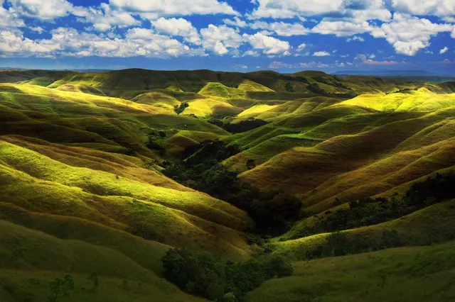
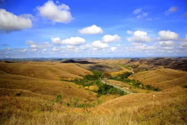
For photography, come to Sumba from late January to April for green hills and full waterfalls, or from July to October for golden savanna; May and June mix both. The best light is the hour after sunrise (about 05:30-06:20 WITA) and before sunset (about 17:45-18:30), and twilight lasts only about 20 minutes. Indonesian rules limit drones to 120 m above ground, daylight and line of sight, ban flights over crowds and require permission near airports, and in villages you must ask before every photo of people, houses, tombs and rituals.
- Green hills
- Late January to April
- Golden savanna
- July to October
- Sunset in Waingapu
- About 17:45 (June) to 18:30 WITA (late January); twilight about 20 minutes
- Sea sunsets
- West coast all year; north coast about May-August
- Drone height limit
- 120 m (400 ft) above ground; daylight and line of sight only
- In villages
- Ask before every photo; never climb on tombs; no drone without permission
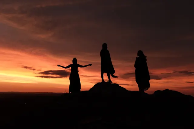
For most of the day the light in Sumba is white and hard. It bleaches the grass and flattens the hills. Then, about an hour before sunset, everything changes: the savanna turns honey and copper, limestone cliffs glow orange and horses throw long shadows across the slopes. Twenty minutes after the sun has gone it is nearly dark. Photography here is a matter of being in the right place for two short windows a day, in the right season, and of remembering that many of the best subjects are people's homes and graves.
The short answer: choose your season by colour (green or gold), plan every afternoon around where the sun sets that month, leave the drone in the bag near airports, crowds and villages unless you have asked, and treat every portrait as a favour.
The light, hour by hour
Sumba lies about 9 to 10 degrees south of the equator. Day length barely changes, but the clock times shift: in Waingapu the sun rises at about 05:30 in November and 06:15 in July, and sets at about 17:45 in June and 18:30 in late January. The west of the island runs about five minutes behind. Our guide to sunsets and sunrises has the monthly table.
Sumba this week, every Sunday
The week's news, one place worth the trip and practical travel notes. Free, and you get our 7-day Sumba guide (PDF) on signing up.
One email a week. No spam. Unsubscribe in one click. Sumba this week- Dawn: cool and quiet. Hills such as Wairinding and Tanarara work at both ends of the day because the low sun rakes across their folds.
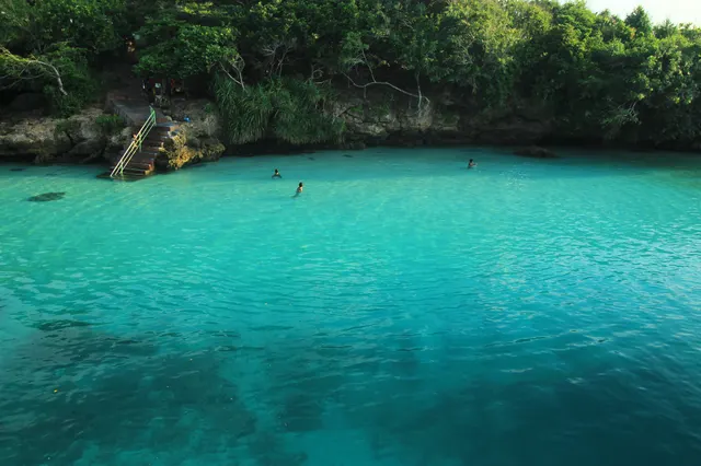
- Midday: harsh. Use it for driving, for shaded village interiors if you are invited in, and for water: the turquoise of Weekuri Lagoon needs a high sun.
- Last hour: the reason to come. Be in position an hour before sunset.
- Blue hour: short. By our calculation civil twilight ends 21 to 23 minutes after sunset. Carry a torch for the walk back.
Where the sun sets, month by month
The sunset swings from about 246 degrees (west-south-west) in late December to about 294 degrees (west-north-west) in late June, and that decides where it meets the sea.
- West coast (Kodi): open ocean to the west, so sunsets over the sea all year. From June into July the sun drops right between the two cliffs at Mandorak.
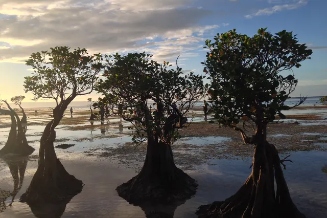
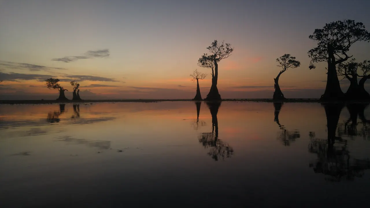
- North coast (Waingapu): from about May to August the sun sets towards the water at Walakiri and Puru Kambera. Walakiri's dwarf mangroves need low tide close to sunset: check a tide table and arrive around 16:30.
- Inland hills: Wairinding does not depend on the coast. It is 30 to 45 minutes from Waingapu.
Green or gold: choosing the season
| Months | What you get | What it costs you |
|---|---|---|
| Late January to April | Green hills, waterfalls at full force | Rain on most days until March, muddy tracks, brown rivers |
| May and June | Patches of green and gold, clear skies, waterfalls running clear | Little: these are the easiest months |
| July to October | Golden savanna, horses on dry grass, the cleanest sunsets | Hard midday light, dust, low waterfalls; haze from grass fires in September |
| November and December | First storms, dramatic skies, hills turning green within days | Unreliable weather and difficult side roads |
Waterfalls are a trade-off between power and clarity. In the rains Lapopu, a 90 m multi-tiered fall, runs brown and strong; in the dry months it is lower but clear. The best compromise is April to June. The reasoning by month is in the best time to visit Sumba.
Drones: what Indonesian rules say
Drones in Indonesia are governed by two Ministry of Transportation regulations: PM 37 of 2020, on operating unmanned aircraft in Indonesian airspace, and PM 63 of 2021 (Civil Aviation Safety Regulation Part 107), for small unmanned aircraft up to 25 kg. Summaries by an Indonesian law firm and by the specialist site Drone Traveller agree on these points:
- Height: no more than 120 m (400 feet) above ground without a permit.
- Daylight and sight: flights only from sunrise to sunset, within the pilot's direct line of sight, with visibility of at least 4.8 km.
- People: no flying over crowds. Over populated areas a route must be approved in advance.
- Airports: approval is required inside an airport's flight operations safety zone (KKOP) and in prohibited or restricted airspace. Sumba has two airports, Tambolaka and Waingapu, so the outskirts of both towns are the wrong place to launch.
- Registration: drones from 250 g to 25 kg are registered through the ministry's SIDOPI-GO system, but only Indonesian citizens and Indonesian legal entities can register, and the remote pilot certificate is open only to Indonesians.
- Commercial work: requires registration, a certified pilot, an operating approval and insurance, plus letters from the authority or owner of the place being filmed. In practice foreign crews work through an Indonesian operator.
What this means for a tourist with a small camera drone is not spelled out. Drone Traveller says it has no official confirmation of how recreational flights by visitors are treated and advises asking the Ministry of Transportation in writing before the trip; it also quotes a reader who was told by the ministry to keep 15 km from airports, which we could not verify in the regulation itself. It adds that flying in an airport safety zone without permission, where air traffic is endangered, can bring up to three years in prison and a fine of up to IDR 1 billion under the Aviation Act. National parks and attractions may also have their own bans or fees: ask on site.
And then there is the local rule, which no ministry wrote. Do not fly over a traditional village, a ceremony, a funeral or the Pasola without asking the village head or your guide first. The space above the tombs is not empty to the people who live there.
Villages and people: etiquette for photographs
- Ask before every photo of people, houses, altars and tombs, and accept a no.
- Sign the guest book and leave a contribution. At Ratenggaro it is around IDR 20,000 or more per person.
- Never climb or sit on a tomb for a better angle, and do not touch ritual objects or buffalo horns.
- Ceremonies: never photograph the body, the rituals or a sacrifice at a funeral without clear permission.
- Children: ask a parent, and do not pay children for pictures. Give to the guest book.
- Pasola: stay at the edge of the field with a long lens. Spears fly and crowds surge.
More in Etiquette in Sumba and Marapu, ikat and traditional villages.
Practical notes for a photo trip
- Transport: sunrise and sunset shoots mean driving in the dark. Hire a car with a local driver rather than riding a scooter at night.
- Power: outages happen. Bring spare batteries and a power bank, and charge whenever you can.
- Weather protection: a dry bag from November to April, something against dust from August to October.
- Time: distances are long. Tambolaka to Waingapu is 4 to 5 hours by car, so give each side of the island at least two evenings.
Frequently asked questions
When is the best time to photograph Sumba?
For green hills and powerful waterfalls, late January to April. For golden savanna and the most reliable sunsets, July to October. May and June give some of both with clear skies and easy roads.
Can I fly a drone in Sumba?
Indonesian rules allow small drones up to 120 m above ground in daylight and within line of sight, away from crowds, and require approval inside airport safety zones around Tambolaka and Waingapu. Registration is open only to Indonesians and the status of tourist flights is not clearly set out, so check with the Ministry of Transportation, and always ask before flying over villages or ceremonies.
Is it allowed to photograph people in Sumba's villages?
Only with permission. Ask before photographing people, houses, altars and tombs, sign the guest book and leave a contribution, and never photograph a body, a ritual or a sacrifice without clear consent.
Where is the best sunset in Sumba?
On the west coast in Kodi (Pero, Mandorak) all year, on the north coast near Waingapu (Walakiri, Puru Kambera) from about May to August, and on the hills of Wairinding in any month.
- Drone dilarang asal terbang, harus ada legalitas operasionalnya, Prolegal, updated 19 Aug 2022
- Drone regulations in Indonesia, Drone Traveller, updated 1 Oct 2026
- Sumba travel 2026: east vs west route and seven essential tips, Telkomsel, 16 Feb 2026
- Open-Meteo historical weather API (sunrise and sunset times for Waingapu)
Spotted an error? Write to info@ecobeachcity.com.
Sumba this week, every Sunday
The week's news, one place worth the trip and practical travel notes. Free, and you get our 7-day Sumba guide (PDF) on signing up.
One email a week. No spam. Unsubscribe in one click. Sumba this week