Place · Travel
Wanokaka Beach, Sumba: Pasola country on the south coast
A wide pale beach at the mouth of a river, where boys race horses at low tide and the March Pasola fills the fields behind: how to visit Wanokaka.
Pantai Wanokaka (also Wanukaka) is a flat white beach at Waihura, on the south coast of West Sumba, beside a broad river delta. It is reached on the paved road south from Waikabubak (Sumba Information gives about 16 km to the Pasola area, then a short way on to the coast). It is busiest at the Pasola, usually in March, and in July-August when fish are plentiful; there is no fixed entrance fee.
- Where
- Waihura, Wanokaka district, south coast of West Sumba
- From the nearest airport
- Tambolaka (TMC): roughly 1.5-2 hours by car via Waikabubak
- Best time
- Late afternoon at low tide; dry season; Pasola usually in March
- Entry
- No fixed fee; the Pasola is free to watch
- Good for
- Local beach life, horse riders, the Pasola
The road from Waikabubak runs down through rice terraces and coconut palms until the land flattens and the light turns silver. Then the sea: a long, pale beach, a river spreading into channels and sandbanks, fishing boats pulled up on the sand. Late in the afternoon, at low tide, boys ride bareback along the waterline, their small horses kicking up spray, practising for the season when this whole valley gathers to watch the Pasola.
Wanokaka is not a resort beach. It is a working coast in one of the heartlands of Sumbanese tradition, and that is the reason to come.
What it is and why go
Wanokaka (spelled Wanukaka in many official documents) is a district on the south coast of West Sumba, south of Waikabubak. OpenStreetMap places Pantai Wanokaka at Waihura village. The Sumba Information guide describes a flat white beach bordering a river delta about 4 km wide, with the fishing village of Pahiwi; you can wade or swim across parts of the delta depending on tide and season, and village youths practise horse racing on the beach at low tide.
Wanokaka is also one of the four areas of the Pasola, the ritual mounted spear battle. The official Indonesia Travel listing for 2024 placed the Wanokaka Pasola at the Bara Bedang field, around March, during the sacred month of the nyale sea worms. In 2025 it was held on 21 March and in 2026 on 9 March, when it was stopped after a brawl among spectators. Dates are set each year by the Rato elders. Read Pasola explained and our Pasola dates guide before planning around it.
How to get there
- From Waikabubak: take the paved road south towards Wanokaka. Sumba Information gives about 16 km to the Pasola area; the beach is a little further on. Allow roughly 30-45 minutes by car.
- From Tambolaka (TMC): about 1 hour to Waikabubak, then the road south; roughly 1.5-2 hours in total.
- From Waingapu (WGP): a full day's drive west; better as part of a stay in West Sumba.
Public bemos run from Waikabubak to the Wanokaka junction, and ojeks (motorbike taxis) operate locally; a 2017 travel account paid around IDR 5,000 for the bus and IDR 20,000 for an ojek back to town, prices that will have risen since. A car with driver is simpler. Sumba Information notes that access to the beach is from the west side of the delta.
When to go and best time of day
- Late afternoon at low tide: the best light, the horse riders and the fishing boats coming in.
- Dry season (roughly May-September): easier roads and calmer river crossings. July-August, when fish are plentiful, brings more people to the beach.
- Pasola season (usually March here): extraordinary, crowded and sometimes tense. Arrive early, stay well back from the field and follow police and elders.
- After heavy rains: Sumba Information warns that the western part of the beach can be washed away temporarily after the monsoon.
Tips and etiquette
- Fees: there is no fixed beach fee. Spectators do not pay for the Pasola (Indonesia Travel lists it as free), but parking or small donations may be asked.
- Swimming: use judgement. River mouths change with the tide and season, and currents can be strong; ask locals before going in.
- Photos: ask before photographing riders, fishermen or children. During the Pasola, never walk onto the field.
- Bring: water, sun protection and cash in small notes. Facilities are minimal.
- Respect: the Pasola is a Marapu ritual tied to the harvest, not a show. Keep alcohol out of it and dress modestly.
Nearby
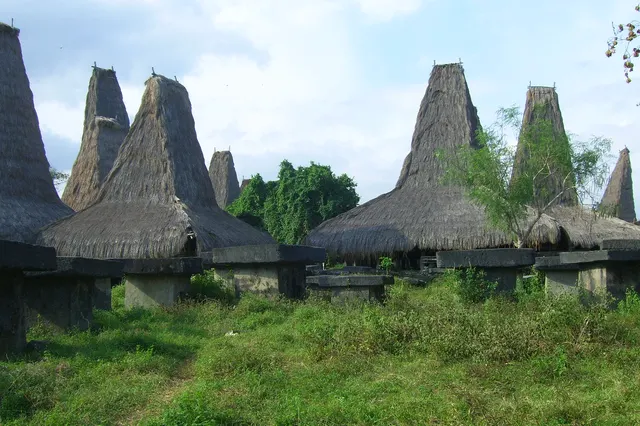
- Praigoli, the traditional village on the hill above the Pasola field.
- Lapopu waterfall, inland to the east in Manupeu Tanah Daru National Park.
- Marosi beach, further west along the coast in Lamboya.
- Waikabubak, the West Sumba capital, about 30-45 minutes north.
Frequently asked questions
When is the Pasola at Wanokaka?
Usually in March, on a date set by the Rato elders each year. It was held on 21 March in 2025 and 9 March in 2026.
How far is Wanokaka beach from Waikabubak?
Sumba Information gives about 16 km to the Pasola area on the road south, with the beach a little beyond; allow roughly 30-45 minutes by car.
Can you swim at Pantai Wanokaka?
Sometimes, but it is a river-mouth beach with changing channels and currents. Ask locals, avoid the water after heavy rain and never swim alone.
Places in this guide
- Pantai Wanokaka · Wanokaka, West Sumba · Open in maps
Distances by road
Wanokaka Beach is in Wanokaka, West Sumba, on the island of Sumba, Indonesia: 59 km by road from Tambolaka Airport (TMC) (about 1 h 25 min to 1 h 45 min) and 149 km from Waingapu Airport (WGP) (about 3 h 35 min to 4 h 25 min).
- Regency
- West Sumba (Sumba Barat)
- From Tambolaka Airport (TMC)
- 59 km by road, about 1 h 25 min to 1 h 45 min driving
- From Waingapu Airport (WGP)
- 149 km by road, about 3 h 35 min to 4 h 25 min driving
- Nearest town
- Waikabubak: 19.3 km by road, about 30 min to 35 min
- Coordinates
- -9.7441, 119.4518 · Open in Google Maps ·
- Sunrise and sunset
- Sunrise from 05:30 (November) to 06:20 (July); sunset from 17:48 (May) to 18:30 (January), local time (WITA). Calculated for these coordinates on the 15th of each month.
Combine it in one day. The closest places by road from here, with the driving time between them:
- Praigoli3.1 km · under 10 min
- Praijing village15.8 km · 25 min to 30 min
- Waikabubak18.2 km · 25 min to 30 min
Road distances were calculated on 18 November 2026 with the OSRM routing engine on OpenStreetMap roads. Driving times are our estimate at an average of 34 to 42 km/h without long stops, the pace at which the 170 km between Tambolaka and Waingapu take 4 to 5 hours. All distances between towns and places →
Nearby places
- Praigoli3 km straight-line (map point approximate)
- Lapopu waterfall9 km straight-line
- Matayangu waterfall10 km straight-line
- Praijing village12 km straight-line
Straight-line distances between map points; roads are longer. Getting around Sumba: car with driver, scooter, buses and real driving times
- The Southwest of Sumba, Sumba Information (Wanukaka beach and Pahiwi), accessed Nov 2026
- Pasola Sumba Barat (event listing, 2024), Indonesia Travel, Ministry of Tourism
- Sumba: Wanokaka and Lemboya, The Spice Route End (travel blog), 2017
- Dari atraksi budaya ke kepanikan: ritual adat Pasola Wanokaka berakhir oleh kericuhan, Waingapu.com, 9 Mar 2026
- Pantai Wanokaka, OpenStreetMap / Nominatim (coordinates)
Spotted an error? Write to info@ecobeachcity.com.
Sumba this week, every Sunday
The week's news, one place worth the trip and practical travel notes. Free, and you get our 7-day Sumba guide (PDF) on signing up.
One email a week. No spam. Unsubscribe in one click. Sumba this week