Guide · Travel
Hiking in Sumba: national parks, Mount Wanggameti and savanna hills
Forest trails and waterfalls in Manupeu Tanah Daru, the 1,225 m summit of Wanggameti, golden savanna walks near Waingapu, and how to hike safely.
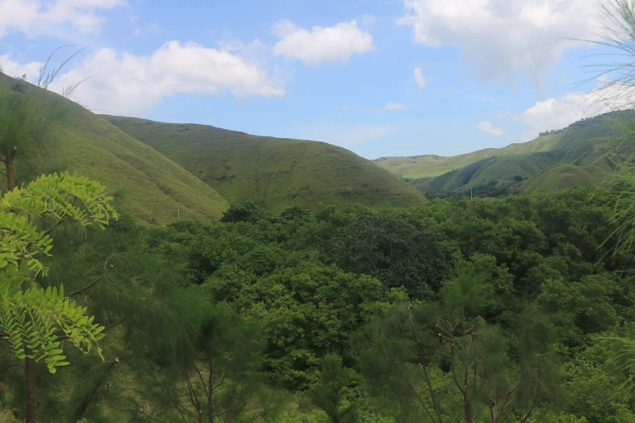
Sumba's best hiking is in Matalawa National Park: Manupeu Tanah Daru in West and Central Sumba for waterfalls, forest walks and endemic birds, and Laiwangi Wanggameti in the south-east, where Gunung Wanggameti (1,225 m), the island's highest point, is reached on a hike of about 14 km return, around 4 hours by car from Waingapu. Easy savanna walks include Wairinding and Bukit Persaudaraan near Waingapu. Go in the dry season (roughly May-October), start at dawn, carry all your water and hire a local guide.
- National park
- Matalawa (Manupeu Tanah Daru + Laiwangi Wanggameti), integrated in 2016
- Highest point
- Gunung Wanggameti, 1,225 m
- Wanggameti hike
- About 14 km return, roughly 3 h each way; no water on trail
- Getting there
- About 4 h by car from Waingapu to Wanggameti village
- Best season
- Dry season, roughly May-October; start at dawn
- Must have
- Local guide, 2-3 l of water per person, sun protection, closed shoes
At first light on the road west of Waingapu, the hills look like a crumpled blanket of gold, each fold catching the sun a few seconds after the last. A horse stands alone on a ridge. Higher up, in the south-east, the grass gives way to dark forest dripping with moss, where hornbills call across the valleys and the air smells of wet earth. Sumba is not a mountain island like Lombok or Flores, but it is a superb place to walk, as long as you go prepared.
The short answer: the best hiking in Sumba is in its two protected forests, now managed together as Matalawa National Park: Manupeu Tanah Daru in West and Central Sumba, for waterfalls, forest trails and endemic birds, and Laiwangi Wanggameti in the south-east, home to Gunung Wanggameti (1,225 m), the island's highest point, reached on a hike of about 14 km return. Add short savanna walks such as Wairinding and Bukit Persaudaraan near Waingapu. Go in the dry season (roughly May-October), start early, carry all your water and hire a local guide.
Sumba's hiking at a glance
| Where | Type | Effort | Base |
|---|---|---|---|
| Gunung Wanggameti (Laiwangi Wanggameti NP) | Forest summit hike, about 14 km return | Moderate to hard, full day | Waingapu (about 4 h by car) |
| Manupeu Tanah Daru NP | Forest walks, waterfalls, birding | Easy to moderate | Waikabubak |
| Wairinding Hill | Savanna viewpoint, short walk | Easy | Waingapu (30-45 min) |
| Bukit Persaudaraan | Sunset hill | Easy | Waingapu (10-15 min) |
| Puru Kambera | Savanna and coast walks | Easy | Waingapu (45-60 min) |
Matalawa: one national park, two forests
Sumba's two national parks were both created in 1998 and were integrated in 2016 under a single management, Matalawa National Park (the name joins the first syllables of Manupeu Tanah Daru and Laiwangi Wanggameti). The park office is in Waingapu. BirdLife International lists the area as an important bird and biodiversity area because of species found only on Sumba, and a 2017 park count listed 84 bird species, 10 mammals, 49 butterflies, 29 reptiles and 173 types of tree.
Sumba this week, every Sunday
The week's news, one place worth the trip and practical travel notes. Free, and you get our 7-day Sumba guide (PDF) on signing up.
One email a week. No spam. Unsubscribe in one click. Sumba this weekInfrastructure is minimal. There are no hut systems, few signposts and almost no maintained trails beyond the main access paths. That is part of the charm, but it also means that a local guide is not a luxury.
Manupeu Tanah Daru: waterfalls and birds
Manupeu Tanah Daru covers about 88,000 hectares of steep lowland forest in West and Central Sumba, rising to around 600 m. Its best-known sights are the waterfalls of Lapopu and Matayangu, and its forests protect around 87 protected bird species, including endemic taxa such as the Sumba hornbill, the Sumba yellow-crested cockatoo, the Sumba green pigeon and the apricot-breasted sunbird.
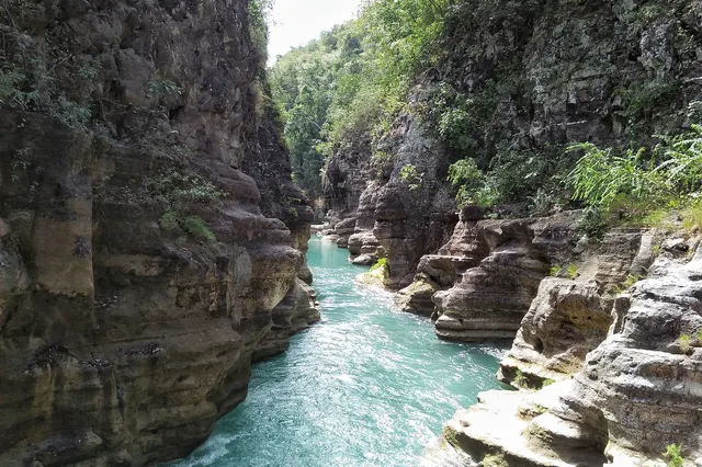
Hiking here usually means half-day walks: a forest track down to a waterfall, a birding walk at dawn, a river crossing or two. Waikabubak, about 1-1.5 hours by car from Tambolaka airport, is the base. Our Manupeu Tanah Daru visitor guide has the entrances, fees and practical details.
Laiwangi Wanggameti and Sumba's highest peak
Laiwangi Wanggameti protects about 470 km² of forest in the south-east of East Sumba, and it is described as containing every forest type found on the island. Its summit, Gunung Wanggameti, reaches 1,225 m.
The hike, as described by the Gunung Bagging route notes (trip reports from 2014, page updated 2025):
- Getting there: from Waingapu allow about 4 hours by car on rough roads to the village of Wanggameti (around 1,000 m), via Tanarara, the last place to buy basic snacks and drinks. Ask for directions at junctions.
- Trailhead: about 1.5 km beyond the national park entrance booth, at roughly 1,160 m, with a sign on the left.
- Distance and time: about 7 km each way, roughly 3 hours each way, with many ups and downs.
- Guide and permit: local guides can be found in the village. A permit was not officially required at the time, but contact the Matalawa office in Waingapu first, especially if you hope to stay overnight at the park post.
- Water: there is none on the trail. Bring everything you need from Waingapu.
- Leeches: very numerous in the rainy season.
The summit is forested, so in cloud there may be no view at all. Go for the forest and the birds, and treat a clear view as a bonus. Full details are in our Laiwangi Wanggameti guide.
Savanna hills and easy walks
The rolling grasslands of East Sumba are the island's signature landscape, and most of the walking there is short, open and spectacular:
- Wairinding Hill, about 20-25 km west of Waingapu on the road to Waikabubak (30-45 minutes): walk down into the folds of the hills at sunrise or late afternoon. Gold in the dry season, green in the wet.
- Bukit Persaudaraan, across from Waingapu airport, about 7 km from town: a grassy limestone hill for an easy sunset walk.
- Puru Kambera, on the north coast 24-26 km from Waingapu: savanna where free-roaming horses graze, down to a calm beach.
The grass on these hills is grazing land, often customary land. Stay on paths, close any gates, do not chase horses or cattle, and ask before walking through fields near villages. Read our explainer on customary land in Sumba to understand why.
When to go
The dry season, roughly May to October (into November in the east), is the time for hiking: trails are firm, rivers low and leeches scarce. The heat on open savanna can be fierce by late morning, so start at dawn. In the rainy season, roughly December to March, the hills turn a brilliant green and waterfalls are at their fullest, but forest trails become muddy and slippery, roads can be cut and leeches thrive. See our guide to the best time to visit Sumba.
Practical safety
- Hire a local guide for forest hikes. Trails are unmarked, paths divide, and a guide also smooths the way with villages and landholders.
- Carry plenty of water: at least 2-3 litres per person for a half day in the heat, more for Wanggameti, where there is no water on the trail.
- Sun protection: hat, long sleeves and sunscreen. Savanna has almost no shade.
- Footwear: closed shoes with grip. Grass hides loose stones, and forest trails are slippery after rain.
- Tell someone your plan and expected return time, and do not rely on finding phone signal in the forest.
- Start early, finish early. Allow for long drives on rural roads and avoid driving unfamiliar roads after dark.
- Leeches and insects: leech socks or long trousers tucked into socks in the wet season, and insect repellent.
- First aid: a basic kit. Medical facilities are limited outside the towns; see our Sumba safety and health guide.
- Respect sacred places. Springs, rocks and groves can be ritual sites. If your guide asks you not to enter or photograph somewhere, follow that.
For the island's other natural highlights, from lagoons to waterfalls, see beaches, lagoons and waterfalls.
Frequently asked questions
What is the highest mountain in Sumba?
Gunung Wanggameti, at 1,225 m, in Laiwangi Wanggameti National Park in the south-east of East Sumba. The hike from the trailhead near Wanggameti village is about 7 km each way, roughly 3 hours each way, through forest; the summit is wooded, so views depend on the weather.
Can you hike in Sumba without a guide?
On short savanna walks like Wairinding or Bukit Persaudaraan, yes. For forest hikes in Matalawa National Park a local guide is strongly recommended: trails are unmarked and divide, there is no water on the Wanggameti trail, and guides also help with village permissions.
Do I need a permit to hike in Sumba's national parks?
Entry to some sites has a ticket, and for Wanggameti a permit was not officially required in recent route notes. Contact the Matalawa National Park office in Waingapu before going, especially to stay overnight, and check current fees on our park pages.
When is the best time for hiking in Sumba?
The dry season, roughly May to October, when trails are firm and leeches scarce. Start at dawn to avoid the midday heat on open savanna. In the rainy season (about December-March) the hills are green and waterfalls full, but trails are muddy and slippery.
How do I get to Wanggameti from Waingapu?
By car or with a driver: allow about 4 hours on rough roads via Tanarara, the last place to buy snacks and drinks. The trailhead is about 1.5 km beyond the national park entrance booth near Wanggameti village. Public transport is not practical.
Is hiking in Sumba dangerous?
Not if you prepare. The main risks are heat and dehydration on open savanna, slippery trails and leeches in the wet season, getting lost on unmarked forest paths and long distances to medical help. Hire a guide, carry plenty of water, tell someone your plan and start early.
Places in this guide
- Manupeu Tanah Daru National Park · West and Central Sumba · Open in maps
- Laiwangi Wanggameti National Park · East Sumba · Open in maps
- Bukit Wairinding · East Sumba · Open in maps
- Bukit Persaudaraan · Kambera, East Sumba · Open in maps
- Puru Kambera · East Sumba · Open in maps
- Gunung Wanggameti, Gunung Bagging (route notes 2014, updated 10 Jul 2025)
- Sumba's Matalawa National Park lures visitors with ecological attractions, The Jakarta Post, 3 Apr 2017
- Manupeu Tanah Daru National Park, Wikipedia
- Laiwangi Wanggameti National Park, Wikipedia
Spotted an error? Write to info@ecobeachcity.com.
Sumba this week, every Sunday
The week's news, one place worth the trip and practical travel notes. Free, and you get our 7-day Sumba guide (PDF) on signing up.
One email a week. No spam. Unsubscribe in one click. Sumba this week