Place · Travel
Bukit Lendongara, Sumba: Tambolaka's sunset hill
Grassy rolling hills with the sea behind, a short drive from Tambolaka airport: the easiest sunset in Southwest Sumba and what to know before you go.
Bukit Lendongara (also spelled Ledongara or Lendungara) is a savanna hill in Karuni village, Loura district, Southwest Sumba, with views over rolling grassland to the coast. Voice of Indonesia puts it under 30 minutes by car from Tambolaka. It is best at sunset or sunrise; no entrance fee is published, and it is green in the rainy season and golden-brown in the dry season.
- Where
- Karuni village, Loura district, Southwest Sumba, near Tambolaka
- From the nearest airport
- Tambolaka (TMC): under 30 minutes by car, according to VOI
- Best time
- Sunset or sunrise; rainy season for green, dry season for gold
- Entry
- No published fee; a small parking charge is possible
- Good for
- Sunsets, landscape photos, a short walk on arrival day
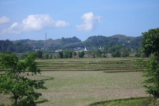
The grass is the first thing you notice: short, dense, rolling over the hills like a carpet that someone has shaken out and left to settle. From the top the slopes fall away in folds towards the plain and the sea, and when the sun drops low the whole landscape turns amber, every ridge outlined, every hollow full of shadow. Wind, crickets, a motorbike far below. That is all.
Lendongara is the sunset hill of Tambolaka, close enough to the airport to fit into an arrival or departure day.
What it is and why go
Bukit Lendongara is a grassy hill area in Karuni village, Loura district, Southwest Sumba Regency, according to Voice of Indonesia (VOI), the international service of Indonesian public radio. VOI describes rolling green hills with a sea backdrop, grass like a carpet that turns brown in the dry season, and an undulating terrain of hills and valleys, and likens it to the "Teletubbies hill" landscapes that made Sumba famous. The Sumba Information guide mentions the high plateau of Lendungara east of Tambolaka, with views over the town and the coastal plain.
Sumba this week, every Sunday
The week's news, one place worth the trip and practical travel notes. Free, and you get our 7-day Sumba guide (PDF) on signing up.
One email a week. No spam. Unsubscribe in one click. Sumba this weekIt is not a trek and has no infrastructure. You come to walk a little, sit on the grass and watch the light.
How to get there
- From Tambolaka town or airport (TMC): VOI says under 30 minutes by car or motorbike (it gives a distance of about 20 km from Tambolaka, which seems long for that time; Sumba Information places the viewpoint about 700 m south-east of the turn-off to Mananga Aba). Your driver will know it.
- From Waikabubak: roughly 1 hour or a little more by car.
- From Waingapu (WGP): a full day's drive; only as part of a west Sumba stay.
There is no public transport to the hill. Rent a scooter or use a car with driver from Tambolaka; see getting around Sumba. We could not verify coordinates for the viewpoint itself; the map point on this page is the centre of Karuni village.
When to go and best time of day
- Sunset: the classic time, recommended by VOI for photos. Arrive an hour before.
- Sunrise: quieter and cooler, with the plain still in shade.
- Rainy season (roughly December-March): green hills, dramatic clouds, slippery slopes.
- Dry season (roughly May-September): gold and brown grass, clear skies, dust.
Tips and etiquette
- Fees: no entrance fee is published. Locals may ask for a small parking fee; carry small notes.
- Private land: the hills are grazing land. Close any gates, keep away from livestock and take all rubbish with you.
- Bring: water, a hat, a torch for the walk down after sunset and shoes with grip.
- Drones and photos: ask before flying over people, houses or animals, and before photographing herders or children.
- Safety: do not leave valuables visible in a parked vehicle and avoid driving unlit back roads late at night.
Plan your visit
Lendongara is ideal for an arrival day or a last evening. Flights from Bali reach Tambolaka in the morning or around midday (FlightConnections listed departures from Bali between about 08:10 and 12:50 in November 2026), which leaves time to check in, rest and drive up for sunset. On a departure day, go at sunrise instead. A gentle first day could combine the Tambolaka market in the morning, Waikelo Sawah waterfall in the afternoon and Lendongara at the end. If you are heading west to Kodi, the hill also works as a first stop before the longer drive to Weekuri and the beaches.
Nearby
- Tambolaka, with its market, the airport and nearby beaches.
- Waikelo Sawah waterfall, a cave-fed waterfall among rice fields.
- Weekuri lagoon, about 1.5-2 hours west.
- Southwest Sumba Regency, our overview of the region.
Frequently asked questions
Where is Bukit Lendongara?
In Karuni village, Loura district, Southwest Sumba, a short drive from Tambolaka town and airport.
Is Lendongara better at sunrise or sunset?
Sunset is the classic choice and the one Voice of Indonesia recommends for photos; sunrise is quieter.
Is there an entrance fee at Bukit Lendongara?
None is published. Bring small notes in case locals ask for a parking fee.
Places in this guide
- Karuni village (centre; Bukit Lendongara viewpoint coordinates not verified) · Loura, Southwest Sumba · Open in maps
Distances by road
Bukit Lendongara is in Loura, Southwest Sumba, on the island of Sumba, Indonesia: 8.7 km by road from Tambolaka Airport (TMC) (about 10 min to 15 min) and 183 km from Waingapu Airport (WGP) (about 4 h 20 min to 5 h 25 min).
- Regency
- Southwest Sumba (Sumba Barat Daya)
- From Tambolaka Airport (TMC)
- 8.7 km by road, about 10 min to 15 min driving
- From Waingapu Airport (WGP)
- 183 km by road, about 4 h 20 min to 5 h 25 min driving
- Nearest town
- Tambolaka: 7.9 km by road, about 10 min to 15 min
- Coordinates
- -9.4296, 119.3028 · Open in Google Maps ·
- Sunrise and sunset
- Sunrise from 05:31 (November) to 06:20 (July); sunset from 17:49 (May) to 18:30 (January), local time (WITA). Calculated for these coordinates on the 15th of each month.
Combine it in one day. The closest places by road from here, with the driving time between them:
- Tambolaka7.5 km · 10 min to 15 min
- Waikelo Sawah waterfall39 km · 55 min to 1 h 10 min
Road distances were calculated on 18 November 2026 with the OSRM routing engine on OpenStreetMap roads. Driving times are our estimate at an average of 34 to 42 km/h without long stops, the pace at which the 170 km between Tambolaka and Waingapu take 4 to 5 hours. All distances between towns and places →
Nearby places
- Tambolaka6 km straight-line
- Waikelo Sawah waterfall19 km straight-line
- Tarung village25 km straight-line
- Waikabubak26 km straight-line
Straight-line distances between map points; roads are longer. Getting around Sumba: car with driver, scooter, buses and real driving times
- Bukit Lendongara, Voice of Indonesia (RRI), 1 Mar 2022
- Waitabula, Tambolaka and Surroundings, Sumba Information, accessed Nov 2026
- Kantor Desa Karuni, OpenStreetMap / Nominatim (village coordinates)
- Direct flights from Denpasar to Tambolaka, FlightConnections, accessed Nov 2026
Spotted an error? Write to info@ecobeachcity.com.
Sumba this week, every Sunday
The week's news, one place worth the trip and practical travel notes. Free, and you get our 7-day Sumba guide (PDF) on signing up.
One email a week. No spam. Unsubscribe in one click. Sumba this week